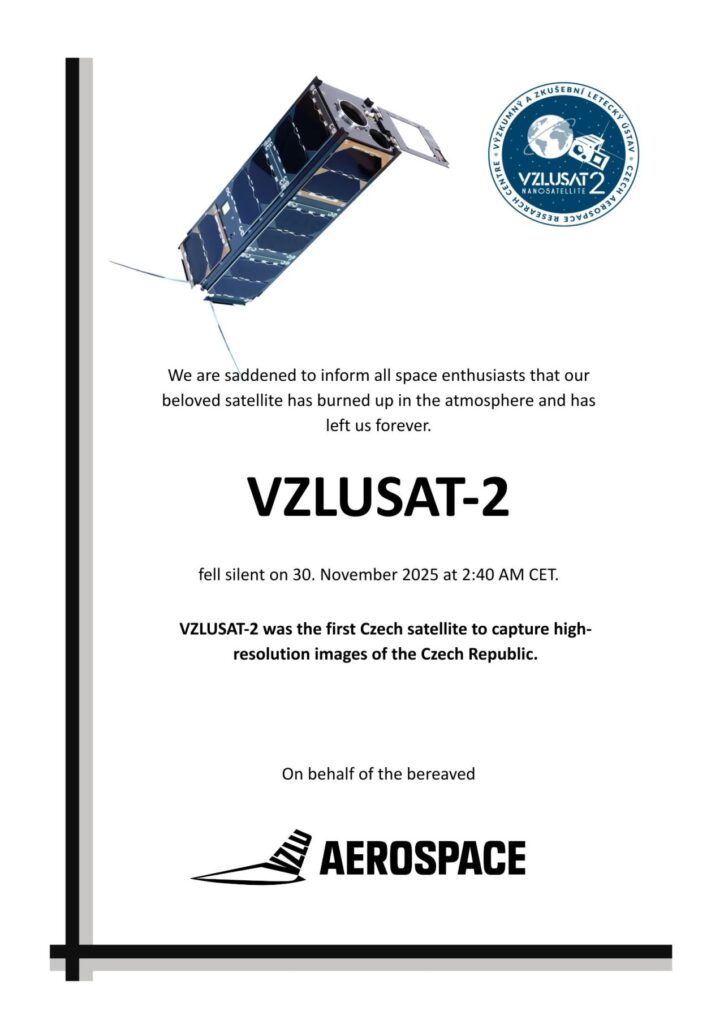
The Czech satellite VZLUSAT-2 has ended its mission. As the first Czech satellite, it was capable of taking high-resolution photos of the Czech Republic. Like every object in orbit, it gradually descended until it entered the atmosphere, where it burned up. VZLU AEROSPACE has published part of the data it took and is offering it primarily to the professional public for further processing and use.
The satellite was last captured by the German research station Neumayer Station III in Antarctica (November 30, 2025 at 01:40 UTC (02:40 CET). A link to the latest observation can be found here. It was launched into space on January 13, 2022, by SpaceX’s Falcon 9 rocket.
VZLUSAT-2 was the Czech Republic’s first satellite, which took high-resolution black and white and color pictures of the Earth. The satellite also had onboard:
- Space Dosimetry System Demonstrator (2SD): measured charged particles (photons, electrons, protons) in the vicinity of the satellite.
- X-ray optical payload: It was used for the detection of X-rays, including an X-ray sensor for the Sun.
- Gamma Flash Detector (GRB Detector): It detected high-energy photons that make gamma-ray bursts.
- Space X-ray Detector (SXD): It measured soft X-rays in space.
- Water vapor outgassing (DPTWI) sensor: It monitored the release of water vapor from the satellite’s materials in a vacuum.
VZLUSAT-2 was designed by the experts at VZLU AEROSPACE (formerly Czech Aerospace Research Centre), where it was also integrated. “VZLUSAT-2 was an important milestone for satellite development at VZLU AEROSPACE. This satellite allowed us to verify our capabilities and technologies, which we utilize in other missions. VZLUSAT-2 has also confirmed the capability of the Czech Republic to develop and operate its own satellites,” explains the CEO of VZLU AEROSPACE, Josef Kašpar.
Part of the data acquired by the satellite, which VZLU AEROSPACE has decided to publish, covers the period from September 2022 to September 2025. Images from both satellite cameras are available after basic decoding and conversion to PNG format. The data also includes measurements from the SXD radiation detectors, some of which capture, for example, coronal eruptions on the Sun. The photographs and data from scientific instruments are available under the Creative Commons license with attribution to VZLU AEROSPACE andare available HERE.
VZLU AEROSPACE currently operates in the orbit satellite SATurnin-1, which was developed for Military Intelligence. Additionally, it is working on the projects AMBIC (Czech eyes in space, expected launch in 2027) and QUVIK (the first Czech space telescope, 2028), which have been selected as ambitious Czech missions. It’s also working on the development of the satellite constellation VZLUGEM (expected launch in 2027), as part of which two satellites will be cooperating in orbit. All these projects follow on from the mission of VZLUSAT-1, which has become Czech’s longest-communicating satellite in the history of the Czech Republic and Czechoslovakia.
Photos and videos to be used with source credit:
Video of the integration of VZLUSAT-2, January 2022: VZLUSAT-2
Final audio recording of last contact with VZLUSAT-2: https://www.vzlusat2.cz/wp-content/uploads/2025/12/Posledni-zvukovy-zaznam-VZLUSAT-2.mp4